Bude to Hartland Quay

31/5/14 I'm afraid that I forgot my camera for this trip. We parked in St Nectans car park in Stoke and then walked back to Hartland for the bus to Bude. After the previous week's exertions, I decided to bring a rucksack this time. I found a site saying that we had ascended over 5000 feet on that trip. A mere 4500 to go this time.

The walk out of Bude is easy enough, even if the lack of signs continued.


But it wasn't long before the ups and downs started. They kept coming.


I was waiting for the Devon border to appear and when we came across the Devon Wildlife Trust site at Marsland, I thought that we were there. But no. Fortunately we soon were though and Sid replenished himself with water from a hut.


There were various animals grazing the cliffs from here.


Embury Beacon marked the high point and we were lucky that the walk after that was mainly a gradual downhill one to Speke's Mill.


The signs there were confusing again, but we soon stumbled into the Wreckers Retreat at Hartland Quay.


Pints of Hartland Quay Bitter and Healey's Cider for £6.80 didn't touch the sides before walking up the hill and back to Stoke.

Boscastle to Bude

24/5/14 Three weeks since our previous walk, so we decided to risk the showery forecast. It was an early start for the drive to Bude. The A30 was busy as you'd expect for the school holidays, but the A road to Bude wasn't. We arrived in time to find a street parking spot and were at the bus stop for the first bus of the day to Boscastle.


Some sausage rolls later, we were on our first ascent. Pentargon with its waterfall was the first bay.


The shale rock looked even darker in the overcast conditions. It wasn't raining, but the ground was wet. Soon we came across the imaginatively named Gull Rock.


On the descent to Rusey, we came across a new born foal.


At the bottom of hill, we chatted to someone whose other half had gone back to check the health of the new born. The next big hill led to another clever place name, High Cliff.


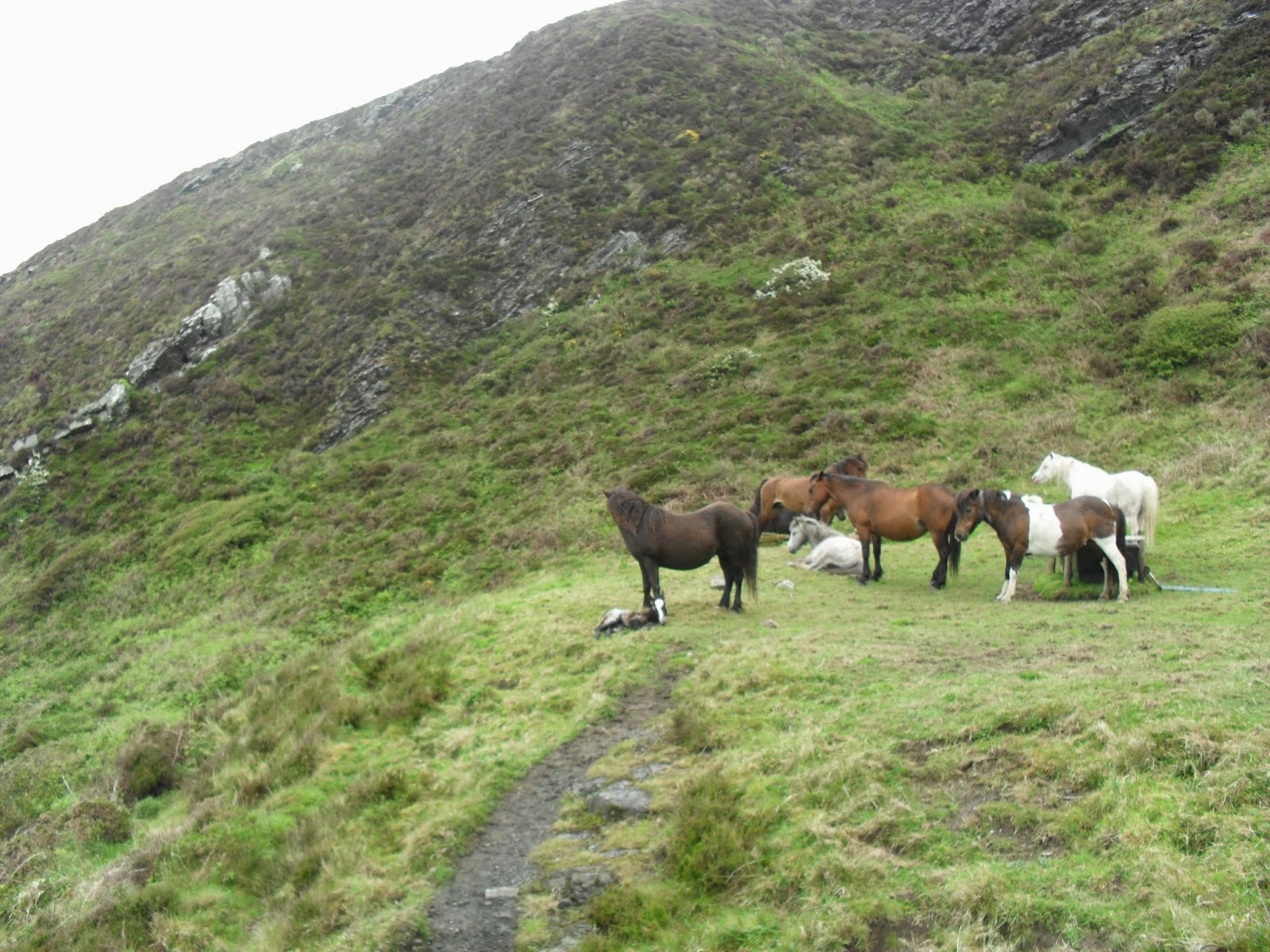
Quite a tough climb, this one. The hills kept coming and shortly after we came across some of the locals enjoying a rest.


The geology at Cambeak looks interesting, but signage is confusing.


After a lap of the headland, we headed down to Crackington Haven.


The Coombe Barton Inn is the large white building near the front. We had pints of Tribute (4.2%) and Arthur's Ale (4.4%) for £6.40 and a couple games of pool. On leaving the pub, we met the party that were looking at the ponies earlier. "Brutal" was how he described the next section. Walking past the pub on the road, we found path signs again and ascended on past the above photograph point. The ups and downs kept coming.


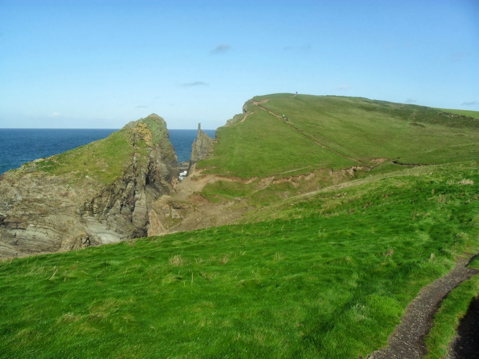
Above is the slightly unnerving descent towards Stoneivy Rock. The climb out towards Dizzard Point nearly finished me off.


It does get gradually easier from here on, but had there been a bus stop in Millook, I wouldn't have completed this section on that day. At Black Rock, the cafe was just about to close as we dragged ourselves in. A pint of cider and some chocolate later, we decided to press on. It started to rain for the first time and, at last, we were glad that we had carried our coats up those hills. We rounded Compass Point and descended into Bude feeling a lot better than we had an hour before. The lack of coastpath signs in the town made us wonder about the correct route, but I think that is a way for the town get you to wander into their shops etc. We returned to the car. It took me another ten minutes to get in though, as cramp was my body's way of telling me how "brutal" it had been.

Port Gaverne to Boscastle

3/5/14 Free car parks in Camelford, so it was the bus to Port Gaverne from there. It started with a steep climb going away from the coast, which set the tone for the next couple of hours. Here is the descent towards Barrett's Zawn.


It wasn't hot, but jumpers were off now and I was happy not to need the cap. Near Dannonchapel, we could look down towards what might have been part of an old quarry.


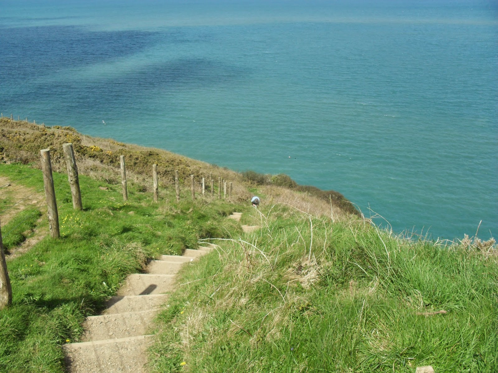
After this came the valley at Jacket's Point. The steps down here disappeared over the cliff, but fortunately they are now fenced off. You might be able to make them out from the picture below.


There was only one more valley at Tregardock before the last big descent to Trebarwith Strand.


The Port William is the first building below this picture. I think we deserved our pints of Tribute (4.2%) and Spring Brew (4.4%) for £6.98. It has the feel of an eating house and is a hotel, but was nice. We had our pasties from one of the shops though.

The old slate quarries became more conspicuous between here and Tintagel. The ships used to moor alongside the quarries themselves.


On arrival at Tintagel Castle, there was a sign saying 4.5 miles to Boscastle. This was a little further than I thought, so we tried to speed up in order to get there to catch the bus. I thought we made it just in time, but I guess it was early. So we killed some time with another pint, pasty and leisurely stroll around the harbour, which made a change from rushing through the resorts. Then it was the last bus back to Camelford.

Rock to Port Gaverne

19/4/14 First walk of the year meant a drive to Port Isaac. From there we bused it to Rock. It is a gentle mile from the bus stop down to the ferry. As it was a sunny Easter Saturday, there were plenty of people around. The walk along the Camel Estuary involved a few dunes, but was relatively easy going.


We stopped for a nice pasty in Polzeath, before the path climbed towards Pentire Point.


The path continues between the cliffs and stone walls for a few miles.


After Port Quin, there are a lot of steps that took their toll on our legs.


Port Isaac was a welcome sight.


There are a couple of bar/restaurants, but just when we thought that we wouldn't find a pub, we stumbled on the Golden Lion Inn.


"Only pub in the village" said the landlord. So we had pints of Trelawny (3.8%) and Tribute (4.2%) for £6.90. Most people were on the balcony, so we had the back bar to ourselves.

We carried on up the hill and around the point. Once we rejoined the road, I had intended to just walk to next bus stop before returning to the car. However, not only was I surprised to see a pub, but also it was on the path as it headed inland.


The Port Gaverne Hotel declares itself to be a freehouse. So it was pints of Doom Bar (4%) and Tribute (4.2%) for £6.50. It was quite busy in the sunshine of the cove, despite the brusque barmaid.

There was still time for another pasty as we returned to Port Isaac for the drive home.

Constantine Bay to Padstow

23/10/13 A midweek drive to Constantine Bay meant another shorter trip on the A30. The last shower of the day happened as we parked the car, then it was down the road to the coastpath.


After walking across the beach and around Booby Bay, it was off towards Dinas and Trevose Head. Near here is one of the holes that seem to happen around here.


The path then went along a muddy section behind the lifeboat station as it descended to Mother Iveys.


As you can see, the sun was out now. We walked across a section of the beach at Harlyn Bay, then back onto the road at the bridge and just missed out on the pub. Then it was Trevone Bay. The path was not too difficult, but there were some hills such as this one by the Merope Islands.


The path continues towards the daymark known as the Pepper Pot. Once there, we followed a path that was going in the right direction back up the Camel estuary, but wasn't the coastpath. We ended up scrambling under a barbed wire fence and down an embankment back onto the path. This was next to the Doom Bar that we had been drinking about.


It was low tide and you can see the water breaking on it here. The path continues along the estuary, between the dunes and the fields for some distance. Eventually the low tide ferry comes into view, but we continue into Padstow, where the high tide ferry lands.


No pubs on this section, so we visit a couple in Padstow before catching the bus back to the car.

Newquay to Constantine Bay

5/10/13 It was a mild October Saturday for another trip down the A30. We parked on street near the railway station. The lack of coastpath signs continued as we headed past some of Newquay's hotels.


Newquay has a nice coastline, but the lack of clues for walkers made it seem a pretty ugly place. By the time we reached Porth, at least we knew where we were going.


The Mermaid Inn lies right on the beach. Pints of Doom (4%) and Betty Stoggs (4%) for £6.70 were ok for morning pints. It is quite a large pub, which was perhaps why they didn't have the pool table bar open. From here it was round to Watergate Bay, which is a large beach that was quite busy for October. A couple of ups and downs later, we were approaching Mawgan Porth.


The Merrymoor Inn looked like a pub from the outside. Pints of Trelawawny (3.8%) and Sharp's Own (4.4%) for £6.40. There were plenty of beaches and it was still busy as we made our way north.


There were the usual ups and downs, but nothing too strenuous. Approaching Porthcothan, there were also plenty of small islands and unusual holes in the cliffs to go with the fine looking beaches. After another busy beach at Treyarnon, we went around to Constantine Bay. We weren't sure where the path went, but we headed inland to the bus stop. Having some spare time before the next bus, we had pasties and followed another path to the beach to find the coastpath.

We were about ten miles from Newquay. The bus deviated to a few villages on the way and took nearly an hour, but more annoyingly cost us £6 each.

Perranporth to Newquay

7/9/13 Another trip to Saltash to retrace our steps to Perranporth with a Ride Cornwall ticket. Walking across the beach, we came across what I thought would be a beach bar. However, the Watering Hole didn't make any claims about its genre, so in we went.


Pints of Proper Job (4.5%) and Tribute (4.2%) for £7 tasted nice enough in this quite large venue. On leaving, we started climbing the dunes, but were soon directed back to the beach.


Eventually we climbed back to the hills and the familiar surroundings of mine and military relics.


Holywell Bay was next.


The pub in Holywell is St Pirans Inn. Two more nice pints of Doom (4%) and Tribute (4.2%) for £6.55.


 From here, we followed the road to a grocers and purchased a couple of pleasant pasties. With a lack of coastpath signs, I asked in the shop for directions. Following her instructions, we dodged the dunes but seemed to be heading inland. Nearing the coast at West Pentire, we decided to cross Crantock Beach. We then crossed the Gannel on the tidal footbridge. We did see some signs near Fistral Beach, but soon had to start guessing again.


The Red Lion has a sign nearby. We had a Fire Raven (4.7%) and North Shore IPA (3.8%) for £5.60. The beer wasn't very nice and the pub didn't impress.


The Fort Inn is just down the road. Proper Job (4.5%) and Tribute (4.2%) for £6.60 were slightly better in this family pub.

We saw another sign down the hill that directed us to some gardens where we tried to stay near the coast and eventually found another sign pointing to a path. At the end of this path is the Griffin. We had two pints of Doom (4%) for £6.60 in another eating house.


The railway station is just across the road and we changed trains in Par and Liskeard to reach Saltash.