Hinkley Point to Combwich

16/5/15 Early bus to Stogursey meant a bit of trek to rejoin the path on the Hinkley Point diversion. I didn't want to just retrace our steps and so tried a different route. Not all of it was easy going.


So we were already a little behind schedule as we joined the 'alternative path' and waved at the patrolling security guards. Then we reached the coast and started to leave the power station behind.


The path is flat and on a good surface here. The flat scenery makes it difficult to judge distances. We head inland along some old sea defences for a bit and then emerge near what I think is the end/start of the West Somerset Coast Path. We didn't see any signs telling us that, but we could some new English Coastal Path signs continuing on towards Steart Point. Those signs led us to a field with various bird hides.


We went into some of the hides looking for something that might tell us where the actual Point is, but without success. So we decide to retrace our steps but this time we keep to the new English Coastal Path/Parrett Trail. It seems to be more of a cycle path, without any cycles. It is still flat and now we were walking into a stiff breeze. Eventually we come out on the banks of the Parrett.


Time is against us as we get into Combwich if we are to make the last bus. But there is just enough to get pints of Old Speckled Hen (4.5%) and bargain East Coast IPA for £4.40.


The barmaid said that we were 20 minutes from the bus stop where the bus was due in 20 minutes time. So we hurriedly downed our pints and I forgot to take a photograph. (So thanks to Ruth http://coastalwalker.co.uk/2014/07/27/153-stert-point-to-bridgwater-river-parrett-trail/ for the above). We leave the trail somewhere near Combwich Wharf.
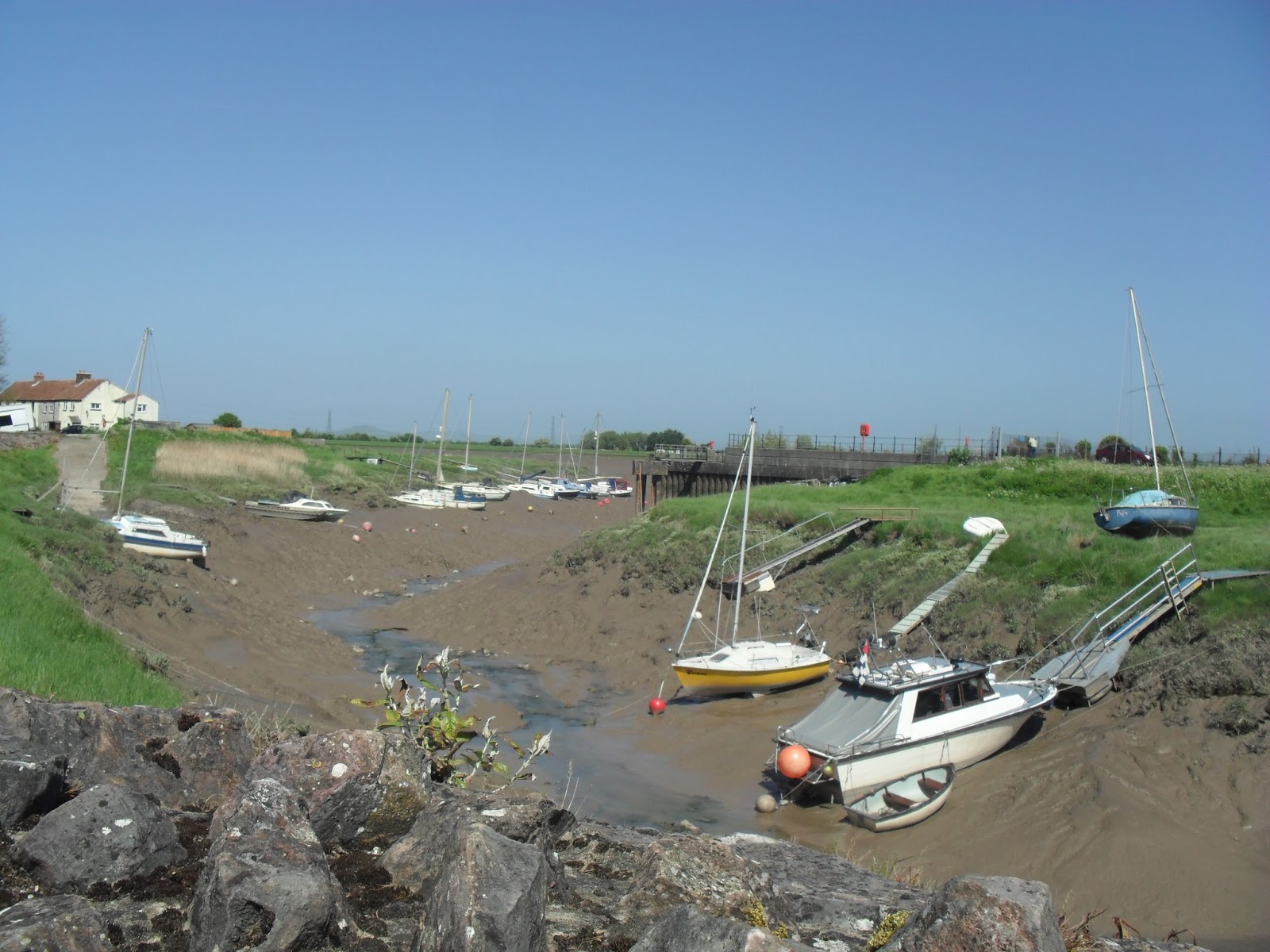

Luckily the bus stop was only ten minutes away for fit, young walkers like us.

West Quantoxhead to Hinkley Point

9/5/15 Bus to near Bicknoller for a short walk along a road to rejoin the West Somerset Coastpath.


We hadn't approached West Quantoxhead from the correct direction on the last walk, but this time we did and strolled on past the Windmill to climb a short hill onto a forest track. The path skirts around the Quantocks on the inside of the A39 for a couple of miles before crossing it and descending back towards the coast.


The coastline here is mainly small cliffs with rock formations sticking out onto the beaches. The wind is behind us as we descend towards Kilve beach.


Shortly after that, Hinkley Point nuclear power station starts to become the conspicuous thing on the horizon.


After Lilstock, we end up on a rocky beach wondering where the path has gone.


The small rocks are interspersed with some bigger ones and large slabs in some places which make the walking a little easier as the tide retreats. Eventually there is some pristine sand to stroll on.


Soon after this the cliffs shrink enough for us to get back onto the path. Just in time as well as the path soon comes to an abrupt stop and gets diverted inland.


The proposed new reactor hasn't started to be built yet, but there is a massive amount of work being done over a large area. An 'alternative path' is signposted along the fence with patrolling vehicles looking at us every so often. After a mile or two, we decide to head inland to Stogursey. By cutting through some fields and past the local sewage plant, we manage to have time for pint in the Greyhound before the bus homewards.

Watchet to West Quantoxhead

4/5/15 Bus to Watchet for opening time. There were already several locals in the Pebbles Tavern.


Pints of Mad Apple (6%) and Uncle Dick's (7%) for £5.60 were a pleasant start to the day. The sort of place that could get noisy and busy with a good selection of beers and ciders. Just across the road is the Bell Inn.


We had pints of Butcombe Crimson King (4.3%) and Exmoor Hound Dog (4%) for £6.60. Nice enough pints in more of a relaxed family pub. Just round the corner is the West Somerset Hotel.


Only gassy Thatchers for us and not many customers, but at least we could play pool and the jukebox was good.

Time for some walking at last as we follow a footpath up the hill inland and out of town. We then cross the road and some fields as we descend towards Williton. We see one footpath sign and skirt around that town before going wrong somewhere and end up on the road into Doniford. We then have a choice of heading inland to try and find the path again, or head towards West Quantoxhead.


The Windmill Inn  is on the A39 in West Quantoxhead. Two pints of Tribute for £7 are alright. The pub is setup as a family eating place on a main road, but there is a small side bar with pool table and jukebox. As it is a bank holiday there are less buses, and so rather than walking on and having to then retrace our steps, we have another pint and walk a mile or so back down the road to another bus stop for the trip home.

Minehead to Watchet

11/4/15 What to do next then? Might as well keep going. The West Somerset Coast Path continues where the SWCP finishes.


The Quay Inn is under new management. They have decided not to open before 12 on a sunny Saturday in the school holidays. So we move on to the Hobby Horse.


Not obviously a pub, but they claimed to have a skittle alley and we had already been denied at one pub. Pints of Tribute (4.2%) and Exmoor Gold (4.5%) for £5.80 were reasonable even if they did taste like the first pints drawn. Didn't find the skittle alley, but they do have a ballroom.

Then it was back to Quay Inn for pints of Otter Ale (4.5%) and Doom Bar (4%) at £6.30. We were the first people in there as well. It hasn't changed from last year and is still aiming for diners.

Time for some walking as we stroll along the front, past Butlins onto a sandy stretch next to the golf course. After Dunster beach, we're onto the pebbles before reaching Blue Anchor. Pretty sure that this place used to be part of the caravan park. Now it is signposted as the Smugglers Inn from the front.


Pints of Smuggled Otter (5.8%) and Patriot's Missile (3.6%) for £7.40 were nice enough, but it was more of a restaurant. At the end of the seafront road is the Blue Anchor Hotel.


Feels like an old pub and at least there were some locals in it around the log fire. Pints of Otter Ale (3.6%) and Bay's Springtime (4.5%) for £6.40.

Then it was up the first hill of the day as we moved in land away from recent cliff erosion. The path goes along a muddy track, through some woods and up and down a couple of hills before coming out overlooking Watchet.


Descending the road into the town, the London Inn backs onto harbour wall. The inside felt as run down as the outside looks. Two pints of Exmoor (3.8%) were not nice either.


We just had time after that for a shop pie before catching the Webbers bus back home.

Porlock to Minehead

13/9/14 Our second walk in Somerset and the second time a bus didn't turn up. This time we waited for the next one and arrived in Minehead too late for our connection. So a couple of pints and a pasty later, it was the afternoon when we finally bused into Porlock and walked down Sparkhayes Lane to rejoin the path. It starts on the marshes towards Bossington, but you can see the hills ahead. Just as we get near to the coast again, we turn right and start our ascent of Hurlestone Combe.


The path keeps going up beyond there and eventually stops ascending just short of 300m and quite a way inland. It feels more like a moorland walk than a coastal one for a few miles.


When we do turn towards the coast again, we soon enter the woods and only catch glimpses of the coast as we descend. As we near Minehead, we emerge into a park and then the Old Ship Aground appears.


We have pints of Ringwood Best (3.8%) and Boondoggle (4.2%) for £6.70. The pub, like the rest of Minehead, had many Butlins tourists. The harbour is just the other side of the pub.


From here it is only a couple of hundred yards to the end of the path.


We go to the next pub to celebrate, but decide to catch a bus somewhere less touristy for the next ones.

Lynmouth to Porlock

6/9/14 A drive to Porlock offered a different route to the coast. We parked just off Sparkhayes Lane and walked into the centre to catch the bus. Our first bus in Somerset did not turn up. Some locals suggested that Quantock had gone bust. Four Bavarian ladies were also waiting and asked if we would share a taxi towards Lynmouth. A few phone calls later, we were racing over the moor and the ladies alighted at the top of Countisbury. £35 didn't seem too bad when we arrived in Lynmouth. We were 20 minutes later than planned, but the pubs still weren't open, so we had a couple of pints in the restaurant just over the footbridge. After a short walk along the front, we started the climb towards Countisbury. The path doesn't stray far from the A39. There had been some rain earlier and it was still misty.


As the path heads towards Foreland, the scenery changes again. We are back into post-glacial valleys.


After this, we enter the woods. The path stays in the woods for more than two hours. We're not sure what the weather is doing. We catch occasional glimpses of the sea, but spend most the time well above it. We go up and down a few combes. Eventually, we come out in Culbone.


It's back into the woods again for a while, but after Worthy Combe there are a couple of fields before Porlock Weir.


The path comes out besides the Ship Inn.


We have Otter Amber Ale (4%) and Porlock Stock and Two Empty Barrels (4.1%) for £6.70. There are a few locals inside and few tourists outside.


The path goes along the road before descending onto the stony beach. After a while it heads inland because the sea defences are not being maintained here now and land behind the beach is being allowed to flood. Some trees are dying.


Sparkhayes farm is only a couple of fields from the path and the car a similar distance beyond.

Combe Martin to Lynmouth

30/8/14 A few showers as we drove across Exmoor to Combe Martin, but they stopped by the time we parked near the church for £1. A local pasty later, we started the climb out. Past Little Hangman, then onto the moorland and Great Hangman at 318m, the highest point on the path.


Then it was down into Sherrycombe and up onto Holdstone Down. The hills are large around here. We skirt around the edge of some fields before heading towards the cliff tops.


The rocks in the distance are Highveer and around the corner is Heddon's Mouth. We have to head inland to get there because the sides are steep and covered in scree.


By the time that we get to the bottom, we are close enough to the Hunters Inn to justify a deviation. A couple of pleasant pints in a pub that wasn't as snooty as it looked. We are soon back up the hill above the cliffs though.


Next come Woody and Lee Bays. Lee Abbey is in the distance.


Over the brow of the hill from the abbey is the the Valley of the Rocks and its inhabitants.


The path is tarmacked along the cliff here into Lynton. We don't really see much of the town though because soon after the cliff railway, we have to head down the hill.


The winding path brings us out on the front in Lynmouth. Just around the corner the thatched Rising Sun overlooks the small harbour and River Lyn.


The small pub is quite busy. We have pints of Exmoor Ale (3.8%) and Gold (4.5%) for £6.90. We then have time to wonder around this touristy village before catching the bus back to Combe Martin.