
Some sausage rolls later, we were on our first ascent. Pentargon with its waterfall was the first bay.

The shale rock looked even darker in the overcast conditions. It wasn't raining, but the ground was wet. Soon we came across the imaginatively named Gull Rock.

On the descent to Rusey, we came across a new born foal.
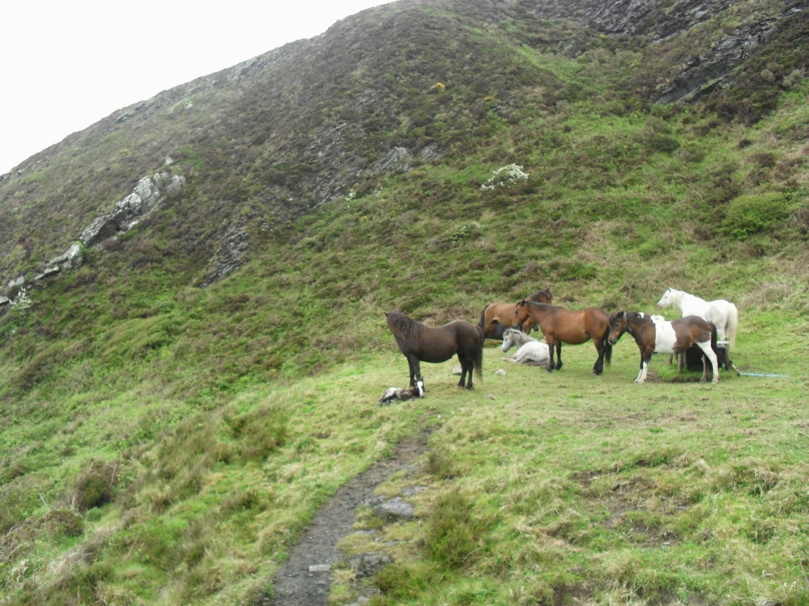
At the bottom of hill, we chatted to someone whose other half had gone back to check the health of the new born. The next big hill led to another clever place name, High Cliff.

Quite a tough climb, this one. The hills kept coming and shortly after we came across some of the locals enjoying a rest.

The geology at Cambeak looks interesting, but signage is confusing.

After a lap of the headland, we headed down to Crackington Haven.

The Coombe Barton Inn is the large white building near the front. We had pints of Tribute (4.2%) and Arthur's Ale (4.4%) for £6.40 and a couple games of pool. On leaving the pub, we met the party that were looking at the ponies earlier. "Brutal" was how he described the next section. Walking past the pub on the road, we found path signs again and ascended on past the above photograph point. The ups and downs kept coming.

Above is the slightly unnerving descent towards Stoneivy Rock. The climb out towards Dizzard Point nearly finished me off.

It does get gradually easier from here on, but had there been a bus stop in Millook, I wouldn't have completed this section on that day. At Black Rock, the cafe was just about to close as we dragged ourselves in. A pint of cider and some chocolate later, we decided to press on. It started to rain for the first time and, at last, we were glad that we had carried our coats up those hills. We rounded Compass Point and descended into Bude feeling a lot better than we had an hour before. The lack of coastpath signs in the town made us wonder about the correct route, but I think that is a way for the town get you to wander into their shops etc. We returned to the car. It took me another ten minutes to get in though, as cramp was my body's way of telling me how "brutal" it had been.


